The Reality of Monsoon Flooding and Vulnerable Communities
Monsoon rains exact a heavy toll on local communities across Northern Luzon. The human cost remains the most devastating aspect of these seasonal surges. Recent drowning incidents claimed the lives of Kenneth Villarte, Alipio Duquino, and a 13-year-old victim. These tragedies underscore the immediate danger facing residents in low-lying areas.
The scale of the inundation stretches municipal resources to their limits. During a recent severe weather event, 14 towns and cities in Pangasinan flooded, affecting 155 barangays. Tracking data indicates floodwaters reached depths of roughly 0.5 to 1.2 meters in the most depressed barangays.
The Provincial Disaster Risk Reduction and Management Office (PDRRMO) verified the extent of the disaster by cross-referencing municipal situation reports with rapid field assessments before officially declaring a state of calamity. Field teams completed these initial rapid damage assessments within about 24 to 36 hours of the monsoon surge. This rapid verification process allows provincial authorities to deploy targeted relief to the hardest-hit zones.
Analyzing Infrastructure Challenges and Environmental Risks
Heavy rainfall alone does not explain the persistent inundation in coastal municipalities. Dagupan City presents a clear example of how environmental factors and infrastructure design collide. Engineers observed that water backflow during the high tide cycle severely compounds the rain. Tidal surges peak between roughly 1.4 and 1.6 meters above normal levels, pushing water back into the city's drainage network.
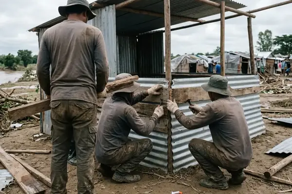
This compounding effect prompted an August 19, 2016 inspection by Rep. de Venecia, Mayor Fernandez, and Engr. Dion. Their assessment revealed that man-made channels cause unintended water redirection. Channel width constrictions narrow from about 18 meters down to 12 meters at critical choke points, creating severe bottlenecks during peak flow.
Note: Tidal flooding in coastal areas like Dagupan requires different sandbagging schedules compared to purely rain-fed flooding in inland Sta. Barbara. Coastal defense teams must align their physical barriers with the lunar tide cycle rather than just the precipitation forecast.
The Role of Community-Based Disaster Risk Reduction

Effective disaster response relies on localized knowledge and preparation. The Community-Based Disaster Risk Reduction Management (CBDRRM) framework builds this capacity at the grassroots level. Initially, the DILG considered a centralized, top-down seminar approach for 104 National Capital Region (NCR) barangays. They discarded this model after pilot tests showed poor community retention.
Instead, they opted for localized workshops. These collaborative sessions involved the DILG, AusAID, and DRRNet-Phils in an ongoing partnership since 2013. Workshop modules spanned 3 to 5 days per barangay cluster. The training rollout executed over a 23-month period from June 2013 to May 2015. This sustained effort secured the commitment of 104 NCR barangays to community disaster preparedness, shifting the focus from reactive rescue to proactive risk reduction.
Implementing Pre-Emptive Evacuation Protocols
Evacuation delays occur when families wait for waist-deep water instead of mobilizing at ankle-deep triggers. Overcoming this hesitation requires decisive action from local authorities during full alert status. Emergency managers Rhodyn Luchinvar Oro and Melchito Castro coordinated the deployment of rescue assets by prioritizing Sta. Barbara based on upstream river gauge readings hitting critical thresholds.
The pre-emptive evacuation window executed around 4 to 6 hours before the projected flood peak. This tight timeframe demanded close coordination between the PDRRMO, the Office of Civil Defense (OCD), the Philippine National Police Provincial Office (PPPO), and the Bureau of Fire Protection (BFP).
Their combined efforts resulted in the successful mobilization of around 160 families in central Pangasinan and an additional 500 families specifically in Sta. Barbara. Moving residents before floodwaters cut off access routes remains the most effective strategy for preventing casualties.
Household Pre-Emptive Evacuation Checklist
- Monitor local river gauge readings (meters above sea level) via municipal radio or SMS alerts.
- Pack a 72-hour emergency kit (E-Learning Pack guidelines recommend waterproof containers for documents).
- Identify the designated municipal evacuation center and map out the safest route before water levels rise.
Scope and Limitations of Current Flood Mitigation Efforts
While pre-emptive evacuation guarantees immediate safety for vulnerable residents, long-term infrastructure solutions like proposed dikes require extensive time and funding. Until these permanent structures materialize, local governments must rely on seasonal readiness and agile logistics.
The transition from dry-season operations like Oplan Sum-Vac to rainy season readiness required the PDRRMO to reallocate quick-response logistics. They shifted from heat-related medical supplies to water rescue gear. This logistical transition executed over a 10 to 14-day period at the onset of the monsoon season.
Summary: Continuous downpours complicate the monitoring of critical river elevation thresholds, which sit at roughly 7.5 to 8.2 meters above sea level. Relying on upstream river elevation gauges provides adequate warning for downstream municipalities, but fails to account for sudden localized flash floods caused by saturated urban drainage systems. Local disaster management councils must balance regional river monitoring with hyper-local drainage assessments to protect their communities effectively.


Comments
No comments so far.
Add Your Thoughts